Competition Living at Lake Rheinau
Mannheim
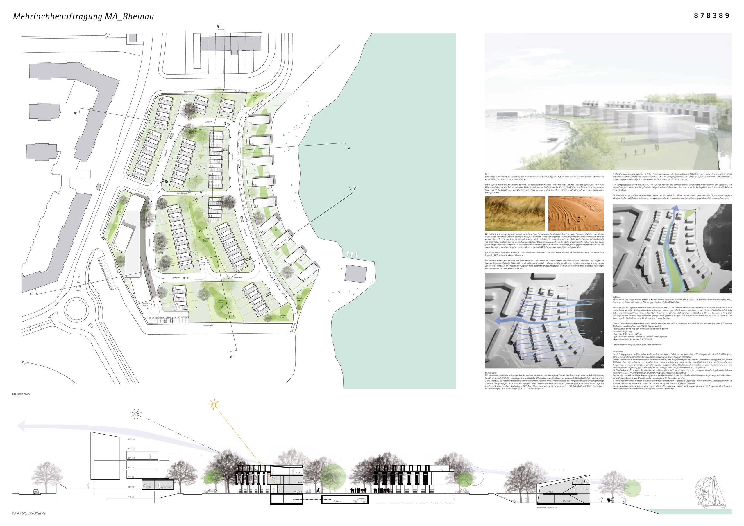
Waterfront Location, Water Sports, and the Significance of Wind Flow in east/west and north/south directions are key characteristics of the property, as highlighted in the available reports.
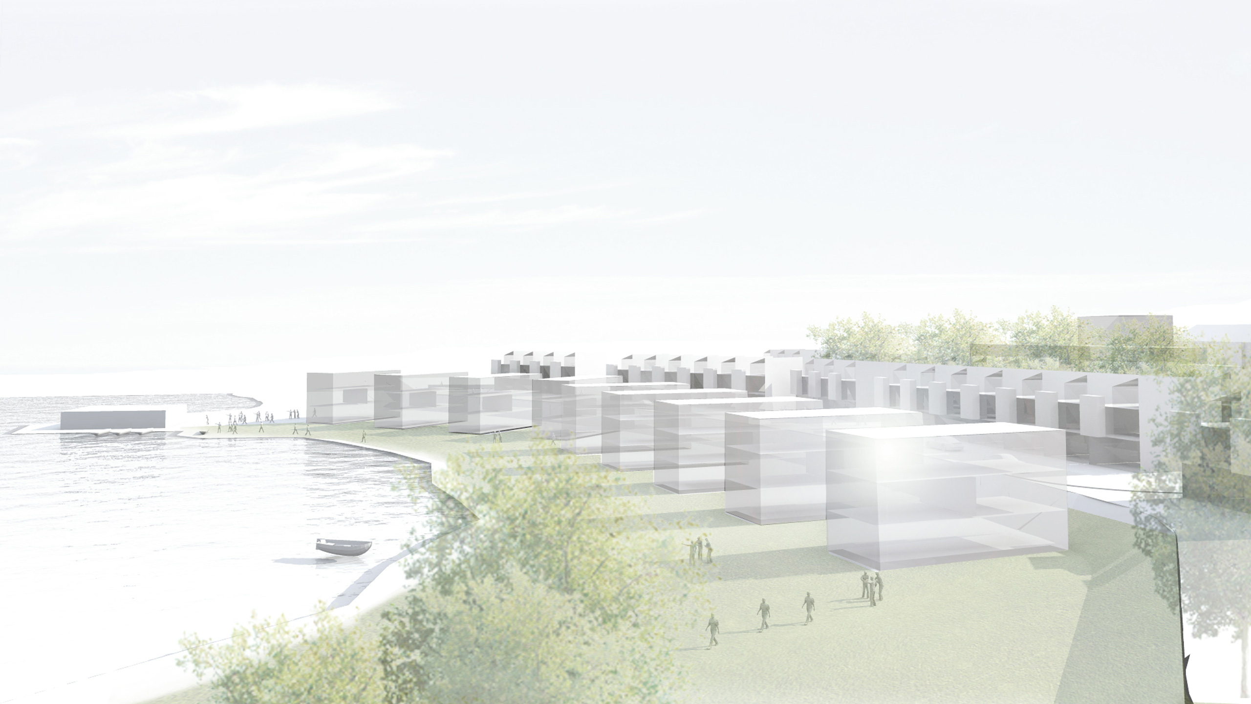
We want to address these aspects in our urban design concept: wind leaves traces—on water, in fields, in desert landscapes, etc. From this, images emerge—fascinating graphics composed of structures, surfaces, and colors. We sought to create a form that could represent an image of a trace left by the wind. At the same time, it should correspond with the already planned access routes.
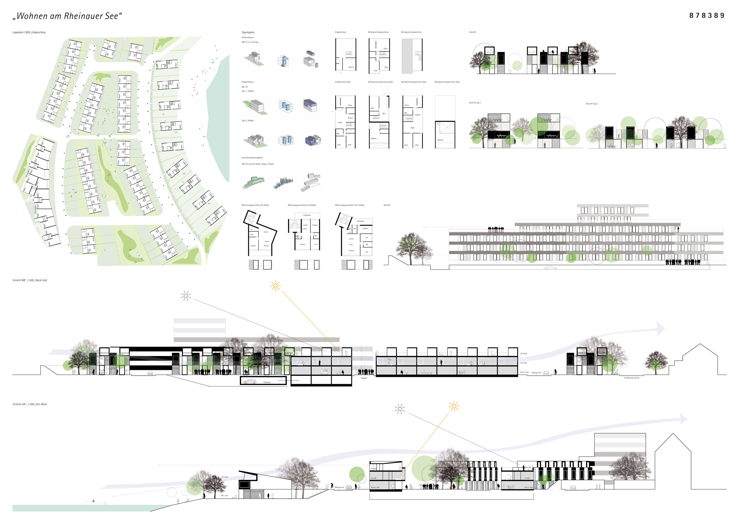
We want to give each future resident a direct visual connection to the water from their home. For this reason, we have chosen flexible building typologies with specific visual characteristics, which can be built as semi-detached houses and row houses. In the first row along the waterline, we propose semi-detached houses, with row houses in the second and third rows—possibly intermixed with semi-detached houses. The row houses are structurally connected on the ground floor and first floor, while on the top floor, the floor plan is halved and complemented by a large rooftop terrace. The building positions are arranged in such a way that these floors are offset from each other, creating views of the lake and allowing for airflow in the E/W direction at every point.
The semi-detached houses will be placed on the existing ground level, creating a direct connection to the shore and offering an attractive elevation for the following residential rows.
The multi-story apartment buildings take on a special role—we are concentrating them on the southwestern part of the property, enhancing the dynamic roof landscape of the semi-detached and row houses into a multi-story design. Layers are stacked, overlapped, and shifted. This creates a dynamic image ("traces"). The height gradation also generates attractive apartments in the multi-story buildings with direct views of Rheinauer Lake.
Access
We will utilize the already constructed routes and the existing utility supply and disposal systems. The middle route is not needed for vehicular access but will serve as a public pedestrian path through the area. The height difference between the roads and the existing ground surface ranges between 2 and 3 meters. We will use this height difference to place an effective underground parking garage (community garage) between two rows of townhouses, allowing for natural lighting. The roof of this garage will be extensively greened, partially paved, and publicly accessible. It will be part of a central open space with a north-south orientation, adjoining private gardens. If necessary, the townhouse complexes can have basements—the remaining areas will be filled in.
The apartment buildings will be raised by half a floor, with the underground level lowered by half a floor. This creates an easily accessible, well-ventilated garage floor and a ground floor that is not visible to passersby. The garden area will be filled in, providing barrier-free access to the ground floor for the residents.
Open Spaces
To protect against traffic noise, we plan to build landscape structures—gabions and embankments of varying heights (at least 3.0 meters). These will surround the building site, tapering off at the edges.
Planting and extensive greening of the private areas will create a park-like setting in the central areas, which, in keeping with the water connection, will become a defining characteristic of the future settlement structure.
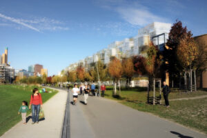
In close proximity to the existing recreational facilities—such as the water-ski area and lawn—we plan to set up a playground. A riverside walking path will roughly follow the current route. Public access points will be connected at various locations, offering visitors a direct connection to the water and places to linger.
Data
Competition
2013
Address
Am Rheinauer See
68219 Mannheim
Awarding Authority
NCC Deutschland GmbH
Partner
AIG Allgemeine Planungs & Ingenieursgesellschaft mbH